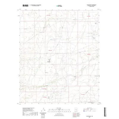
2023 Map of Foster Ranch
USGS Topo · Published 2023About this map
McDonald Cem stands as a focal point for family history in this corner of Eddy County, positioned north of the winding Middle Seven Rivers. The landscape is defined by its drainage patterns and water management, with numerous named draws and tanks supporting ranching operations across the arid terrain. To the south, the Seven Rivers Hills rise above Box Canyon and the unusual topography of Sinkhole Flat. The network of local roads, including Rock Daisy Rd and Sawbuck Rd, provides access to these remote landmarks. This survey by the U.S. Geological Survey captures the contemporary character of the New Mexico backcountry, where seasonal water sources like Horner Tank and Round Tank are essential to the geographic identity of the Foster Ranch area.
Find a feature on this map
29 named features on this map. Tap any name to fly to it.
Don’t see what you’re looking for? This feature index may not catch every label — zoom into the map to look around manually.
Map Details
Editions of this 2023 Foster Ranch Map
This is the sole edition of this map. No revisions or reprints were ever made.
Other maps of this area

1940 · Bandanna Point
USGS Topo · 1:62,500

1943 · Bandanna Point
USGS Topo · 1:62,500

1943 · West Carlsbad
USGS Topo · 1:62,500

1945 · West Carlsbad
USGS Topo · 1:62,500

1954 · Seven Rivers
USGS Topo · 1:24,000

1954 · Carlsbad
USGS Topo · 1:250,000

1955 · Dayton
USGS Topo · 1:24,000

1956 · Parish Ranch
USGS Topo · 1:24,000

1956 · Antelope Sink
USGS Topo · 1:24,000

1957 · Foster Ranch
USGS Topo · 1:24,000