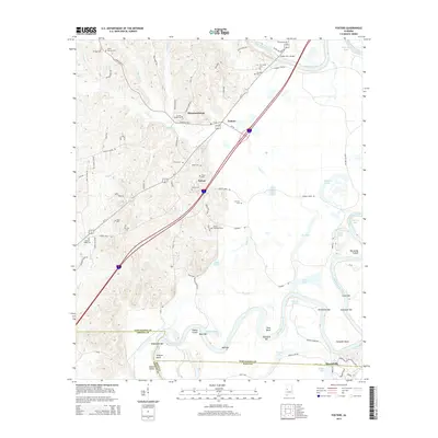
2014 Map of Fosters
USGS Topo · Published 2014About this map
The Black Warrior River dictates the landscape of this West Alabama region, winding through a complex of oxbow lakes and bars including Touson Lake, Moon Lake, and Snag Lake. The settlement of Fosters sits at a critical junction near the Foster Ferry Bridge, while the community of Sylvan is positioned further south along the interstate corridor. This survey reveals a dense concentration of family and community burial grounds, such as Jones Townsend Cem, Beale Cem, and Zion Hill Cem, which offer significant value for genealogical research in Tuscaloosa County. Along the river's southern bends, features like Izzard Shoals and Wilford Bend mark the transition toward Moundville. The map's detail of the riverbank, including Lewis Bar and Vancleave Bar, illustrates the evolving hydrology of the waterway as it flows toward the Greene and Hale County lines.
Find a feature on this map
77 named features on this map. Tap any name to fly to it.
Don’t see what you’re looking for? This feature index may not catch every label — zoom into the map to look around manually.
Map Details
Editions of this 2014 Fosters Map
This is the sole edition of this map. No revisions or reprints were ever made.
Other maps of this area

1924 · Tuscaloosa
USGS Topo · 1:62,500

1926 · Tuscaloosa
USGS Topo · 1:62,500

1927 · Eutaw
USGS Topo · 1:48,000

1931 · Eutaw
USGS Topo · 1:62,500

1953 · Montgomery
USGS Topo · 1:250,000

1953 · Birmingham
USGS Topo · 1:250,000

1956 · Birmingham
USGS Topo · 1:250,000

1956 · Montgomery
USGS Topo · 1:250,000

1957 · Birmingham
USGS Topo · 1:250,000

1957 · Montgomery
USGS Topo · 1:250,000