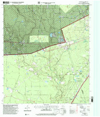
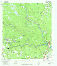
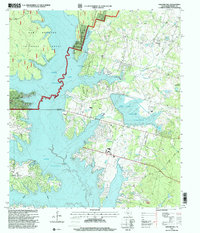
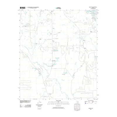
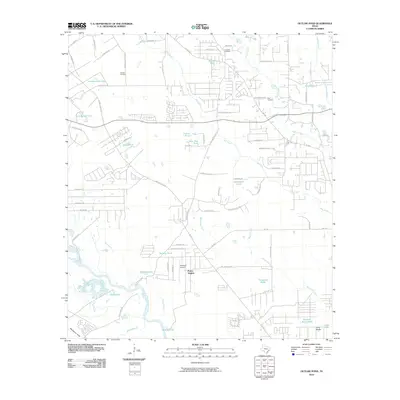
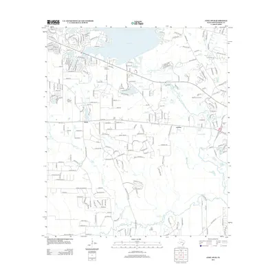
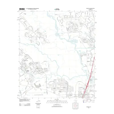
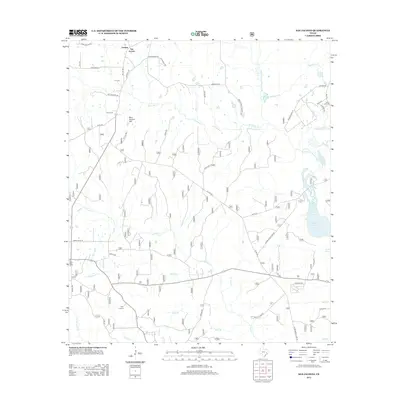
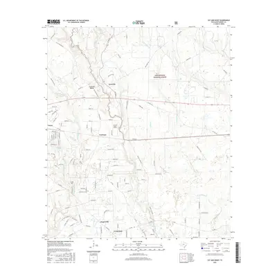
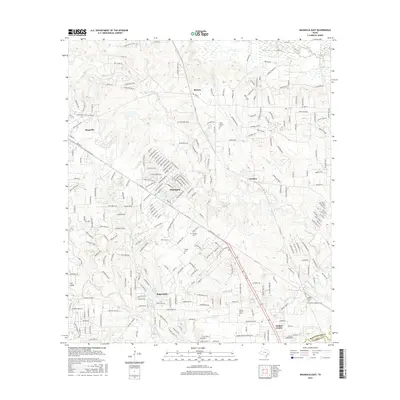
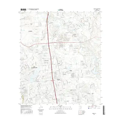
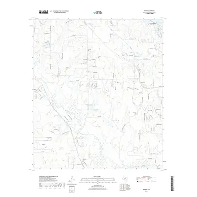
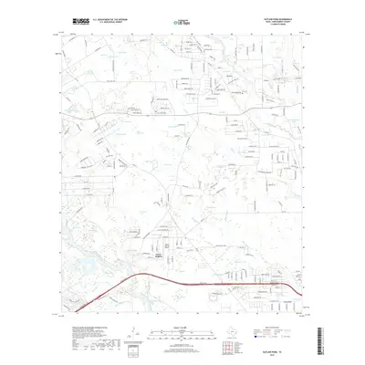
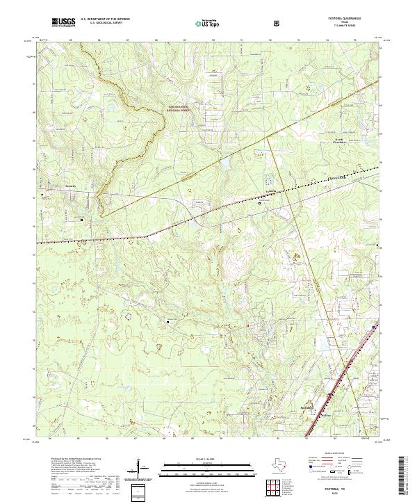
1997 Map of Fostoria
USGS Topo · Published 2000About this map
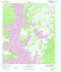
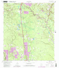
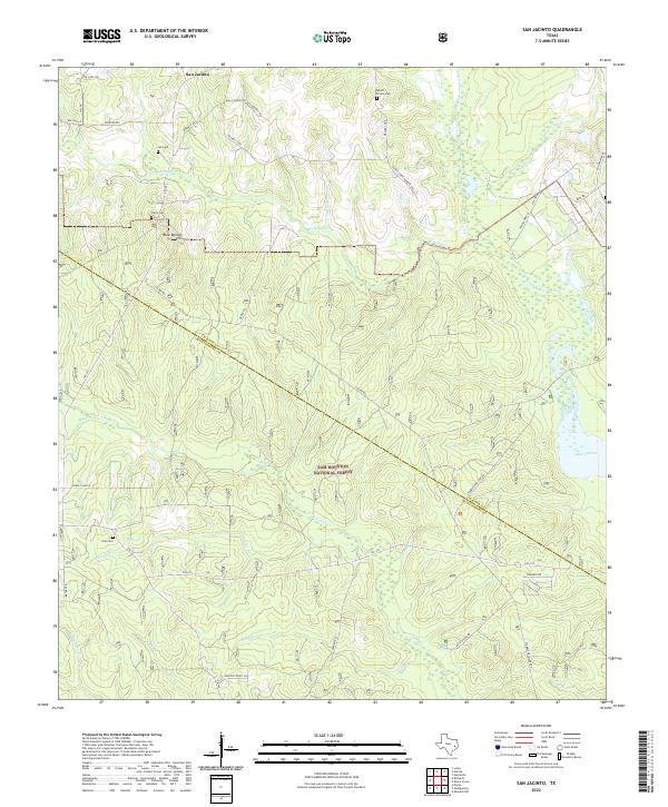
Sam Houston National Forest dominates the northern half of this landscape, where the headwaters of Jayhawker Creek and Peach Creek flow through a network of logging and access routes like Foster Tram Road and Meeking Road. The topography is defined by the convergence of Montgomery, San Jacinto, and Liberty counties, creating a rural character centered on timber and small settlements. In the southern portion, the small community of Fostoria sits near a prominent Cemetery, while Midline and Security anchor the southwestern corridor.
Find a feature on this map
44 named features on this map. Tap any name to fly to it.
Don’t see what you’re looking for? This feature index may not catch every label — zoom into the map to look around manually.
Map Details
Editions of this 1997 Fostoria Map
This is the sole edition of this map. No revisions or reprints were ever made.
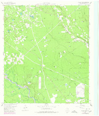
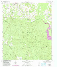
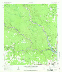
Historical Maps of Cleveland Through Time
72 maps found
1919 Weeden
Montgomery County, TX
1958 Cowl Spur
Montgomery County, TX
1958 Fostoria
Montgomery County, TX
1958 Shepard Hill
Montgomery County, TX
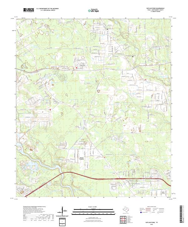
1959 Outlaw Pond
Montgomery County, TX
1959 San Jacinto
Montgomery County, TX
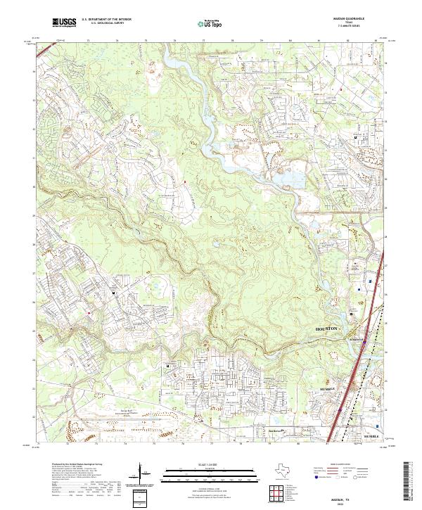
1961 Maedan
Montgomery County, TX
1961 Tamina
Montgomery County, TX
1962 Keenan
Montgomery County, TX
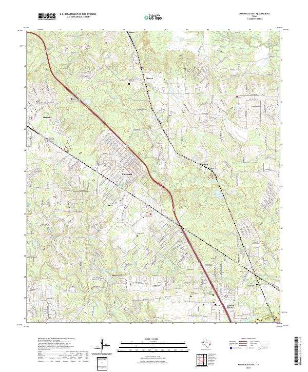
1962 Magnolia East
Montgomery County, TX
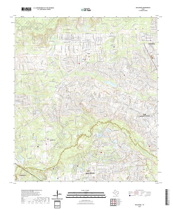
1962 Oklahoma
Montgomery County, TX
1982 Maedan
Montgomery County, TX
1995 Maedan
Montgomery County, TX
1997 Cut And Shoot
Montgomery County, TX
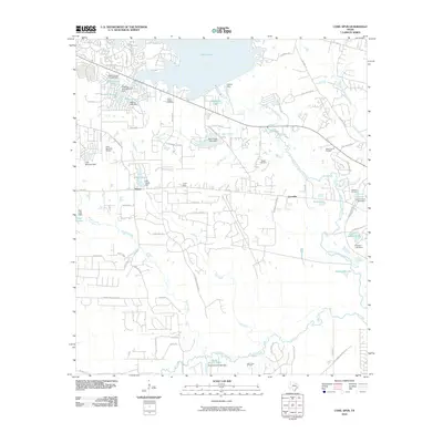
1997 Fostoria
Montgomery County, TX
1997 San Jacinto
Montgomery County, TX
1997 Shepard Hill
Montgomery County, TX
2010 Cowl Spur
Montgomery County, TX
2010 Cut And Shoot
Montgomery County, TX
2010 Fostoria
Montgomery County, TX
2010 Keenan
Montgomery County, TX
2010 Maedan
Montgomery County, TX
2010 Magnolia East
Montgomery County, TX
2010 Oklahoma
Montgomery County, TX
2010 Outlaw Pond
Montgomery County, TX
2010 San Jacinto
Montgomery County, TX
2010 Shepard Hill
Montgomery County, TX
2010 Tamina
Montgomery County, TX
2013 Cowl Spur
Montgomery County, TX
2013 Cut And Shoot
Montgomery County, TX
2013 Fostoria
Montgomery County, TX
2013 Keenan
Montgomery County, TX
2013 Maedan
Montgomery County, TX
2013 Magnolia East
Montgomery County, TX
2013 Oklahoma
Montgomery County, TX
2013 Outlaw Pond
Montgomery County, TX
2013 San Jacinto
Montgomery County, TX
2013 Shepard Hill
Montgomery County, TX
2013 Tamina
Montgomery County, TX
2016 Cowl Spur
Montgomery County, TX
2016 Cut And Shoot
Montgomery County, TX
2016 Fostoria
Montgomery County, TX
2016 Keenan
Montgomery County, TX
2016 Maedan
Montgomery County, TX
2016 Magnolia East
Montgomery County, TX
2016 Oklahoma
Montgomery County, TX
2016 Outlaw Pond
Montgomery County, TX

2016 San Jacinto
Montgomery County, TX
2016 Shepard Hill
Montgomery County, TX
2016 Tamina
Montgomery County, TX
2019 Cowl Spur
Montgomery County, TX
2019 Cut And Shoot
Montgomery County, TX
2019 Fostoria
Montgomery County, TX
2019 Keenan
Montgomery County, TX
2019 Maedan
Montgomery County, TX
2019 Magnolia East
Montgomery County, TX
2019 Oklahoma
Montgomery County, TX
2019 Outlaw Pond
Montgomery County, TX
2019 San Jacinto
Montgomery County, TX
2019 Shepard Hill
Montgomery County, TX
2019 Tamina
Montgomery County, TX
2022 Cowl Spur
Montgomery County, TX
2022 Cut And Shoot
Montgomery County, TX
2022 Fostoria
Montgomery County, TX
2022 Keenan
Montgomery County, TX
2022 Maedan
Montgomery County, TX
2022 Magnolia East
Montgomery County, TX
2022 Oklahoma
Montgomery County, TX
2022 Outlaw Pond
Montgomery County, TX
2022 San Jacinto
Montgomery County, TX
2022 Shepard Hill
Montgomery County, TX
2022 Tamina
Montgomery County, TX