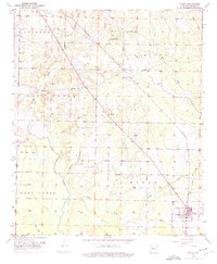
1952 Map of Fouke
USGS Topo · Published 1975About this map
Fouke anchors the southeastern corner of this Miller County landscape, serving as a primary hub for the St Louis Southwestern railroad. The surrounding terrain is defined by a dense network of watercourses, including the winding Days Creek and Boggy Creek, which cut through a mosaic of civil townships like Garland and Beech. A pattern of rural gathering places emerges across the quadrangle, with country churches such as Cedar Grove Ch and Sylverino Ch situated near local roads and the prominent Pipe Line corridor.
Find a feature on this map
27 named features on this map. Tap any name to fly to it.
Don’t see what you’re looking for? This feature index may not catch every label — zoom into the map to look around manually.
Map Details
Editions of this 1952 Fouke Map
5 editions found
Other maps of this area

1907 · Atlanta
USGS Topo · 1:62,500

1909 · Texarkana
USGS Topo · 1:62,500

1910 · Atlanta
USGS Topo · 1:62,500

1952 · Mandeville
USGS Topo · 1:24,000

1952 · Doddridge NW
USGS Topo · 1:24,000

1952 · Fouke SE
USGS Topo · 1:24,000

1952 · Doddridge NE
USGS Topo · 1:24,000

1952 · Fouke
USGS Topo · 1:24,000

1952 · Fouke NE
USGS Topo · 1:24,000

1953 · Texarkana
USGS Topo · 1:250,000