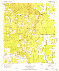
1952 Map of Fouke SE
USGS Topo · Published 1957About this map
McKinney Bayou meanders through this portion of Miller County, defining a landscape shaped by both natural waterways and early 20th-century resource extraction. The area around Holly Springs is a focal point for local history, featuring Holly Springs Ch and a network of rural roads that connect isolated farmsteads and cemeteries. The terrain transitions from the low-lying wetlands of Fish Lake and the Old Channel McKinney Bayou to slightly higher ground where institutions like Central Sch and Macedonia Ch served the local community. Industrial activity is evident in the Gravel Pits and scattered Oil Wells, highlighting the region's reliance on local geology. For genealogists, the map is a detailed record of burial sites, including Phylaw Cem and Rocky Mound Cem, preserved here as they stood in the early 1950s.
Find a feature on this map
25 named features on this map. Tap any name to fly to it.
Don’t see what you’re looking for? This feature index may not catch every label — zoom into the map to look around manually.
Map Details
Editions of this 1952 Fouke SE Map
4 editions found
Other maps of this area

1952 · Mandeville
USGS Topo · 1:24,000

1952 · Garland
USGS Topo · 1:24,000

1952 · Doddridge NW
USGS Topo · 1:24,000

1952 · Fouke SE
USGS Topo · 1:24,000

1952 · Doddridge NE
USGS Topo · 1:24,000

1952 · Fouke
USGS Topo · 1:24,000

1952 · Canfield
USGS Topo · 1:24,000

1952 · Fouke NE
USGS Topo · 1:24,000

1952 · Boyd Hill
USGS Topo · 1:24,000

1953 · El Dorado
USGS Topo · 1:250,000