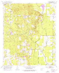
1952 Map of Fouke SE
USGS Topo · Published 1976About this map
The bottomlands of the Red River and the low ridges of Cleveland and Beech define this mid-century landscape in Miller County. This 1952 topographic survey, with later purple revisions from 1975, documents a dispersed rural community connected by small country churches and family burial grounds. Notable landmarks include the Central Ch and Central Sch in the northwest, while the Macedonia Ch and Holly Springs Ch anchor the central hills. The drainage pattern is dominated by McKinney Bayou and the Old Channel Moccasin Bayou, reflecting the intricate hydrology of the Red River valley. Evidence of local industry appears in the form of scattered Oil Wells and several Gravel Pits, while man-made improvements like the Levee and various Pipeline corridors trace the modernization of the Arkansas countryside during the post-war era.
Find a feature on this map
28 named features on this map. Tap any name to fly to it.
Don’t see what you’re looking for? This feature index may not catch every label — zoom into the map to look around manually.
Map Details
Editions of this 1952 Fouke SE Map
4 editions found
Other maps of this area

1952 · Mandeville
USGS Topo · 1:24,000

1952 · Garland
USGS Topo · 1:24,000

1952 · Doddridge NW
USGS Topo · 1:24,000

1952 · Fouke SE
USGS Topo · 1:24,000

1952 · Doddridge NE
USGS Topo · 1:24,000

1952 · Fouke
USGS Topo · 1:24,000

1952 · Canfield
USGS Topo · 1:24,000

1952 · Fouke NE
USGS Topo · 1:24,000

1952 · Boyd Hill
USGS Topo · 1:24,000

1953 · El Dorado
USGS Topo · 1:250,000