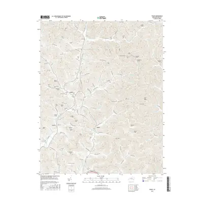
2016 Map of Fount
USGS Topo · Published 2016About this map
Collins Fork and Hammons Fork wind through this corner of Knox County, defining a landscape of narrow hollows and steep ridges such as Horse Pens Ridge. The settlement of Girdler serves as a local hub near the center of the map, while Fount and Hinkle mark other key points of habitation along the creek valleys. The area is notable for its high density of family-named cemeteries, including the Callebs Creek Cem, Hignite Cem, and Clark-Hinkle Cem, which offer significant value for genealogists tracing local lineages. Dramatic terrain features like Clinch Knob and Willis Knob rise above the drainage basins, illustrating the complex topography of the Cumberland Plateau. This 2016 survey also documents the road network connecting these rural communities, from the Cumberland Gap Pkwy in the south to the numerous county roads following the branches and forks of the local waterways.
Find a feature on this map
151 named features on this map. Tap any name to fly to it.
Don’t see what you’re looking for? This feature index may not catch every label — zoom into the map to look around manually.
Map Details
Editions of this 2016 Fount Map
This is the sole edition of this map. No revisions or reprints were ever made.
Other maps of this area

1886 · Cumberland Gap
USGS Topo · 1:125,000

1888 · Cumberland Gap
USGS Topo · 1:125,000

1891 · Manchester
USGS Topo · 1:125,000

1891 · Cumberland Gap
USGS Topo · 1:125,000

1903 · Pineville
USGS Topo · 1:48,000

1952 · Barbourville
USGS Topo · 1:24,000

1952 · Heidrick
USGS Topo · 1:24,000

1952 · Hima
USGS Topo · 1:24,000

1952 · Blackwater
USGS Topo · 1:24,000

1952 · Fount
USGS Topo · 1:24,000