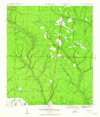
1945 Map of Fountain
USGS Topo · Published 1960About this map
Fountain and Youngstown anchor this mid-century landscape in Bay County, where the Atlanta and St Andrews Bay railroad cuts a nearly straight line through the pine-laden terrain. This corridor was the lifeblood of the local economy, moving timber and turpentine from the surrounding woods. To the west, the tiny settlement of Vicksburg sits near the winding course of Moccasin Cr, while an Old Tramroad in the south provides a physical record of earlier logging operations that once defined this region. Significant landmarks like the Youngstown Lookout Tower underscore the importance of fire management in these vast forested areas. The map also delineates the Base Line and county boundaries with Washington and Calhoun counties, while isolated water bodies like Open Pond and Bear Pond offer a sense of the natural hydrology before modern drainage alterations.
Find a feature on this map
16 named features on this map. Tap any name to fly to it.
Don’t see what you’re looking for? This feature index may not catch every label — zoom into the map to look around manually.
Map Details
Editions of this 1945 Fountain Map
3 editions found
Other maps of this area

1944 · Bayhead
USGS Topo · 1:24,000

1944 · Bennett
USGS Topo · 1:24,000

1945 · Juniper Creek
USGS Topo · 1:31,680

1945 · Youngstown
USGS Topo · 1:31,680

1945 · Bennett
USGS Topo · 1:31,680

1945 · Bayhead
USGS Topo · 1:31,680

1945 · Broad Branch
USGS Topo · 1:31,680

1945 · Fountain
USGS Topo · 1:31,680

1950 · Gap Lake
USGS Topo · 1:24,000

1951 · Gap Pond
USGS Topo · 1:24,000