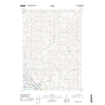
2018 Map of Fountain City
USGS Topo · Published 2018About this map
Fountain City sits at the foot of dramatic bluffs where the Mississippi River forms the state line between Wisconsin and Minnesota. This riverfront landscape is defined by its deep coulees and high ridges, which create a complex network of valleys named for the families who settled them. Local history is etched into the terrain through features like Eagle Valley, Joos Valley, and Bohris Valley, each reflecting the agricultural legacy of the region. The map highlights significant landforms such as Wagners Cliff and Buffalo Ridge, which rise sharply above the river bottoms.
Find a feature on this map
63 named features on this map. Tap any name to fly to it.
Don’t see what you’re looking for? This feature index may not catch every label — zoom into the map to look around manually.
Map Details
Editions of this 2018 Fountain City Map
This is the sole edition of this map. No revisions or reprints were ever made.
Other maps of this area

1929 · Fountain City
USGS Topo · 1:62,500

1932 · Cochrane
USGS Topo · 1:62,500

1932 · Gilmanton
USGS Topo · 1:62,500

1932 · Alma
USGS Topo · 1:62,500

1934 · Winona
USGS Topo · 1:62,500

1934 · Cochrane
USGS Topo · 1:62,500

1937 · Winona
USGS Topo · 1:62,500

1937 · Cochrane
USGS Topo · 1:62,500

1950 · Alma
USGS Topo · 1:62,500

1953 · Eau Claire
USGS Topo · 1:250,000