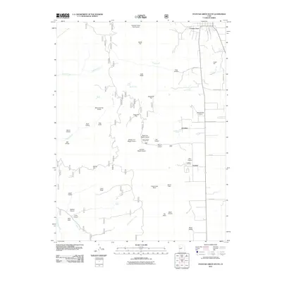
2011 Map of Fountain Green South
USGS Topo · Published 2011About this map
Fountain Green stands at the northern edge of this high valley, where the agricultural flats meet the rising slopes of the Wasatch Range. The landscape is a network of named canyons and ridges, defining the rugged transition from the settlement at Jerusalem to the recreational areas at Maple Canyon Campground. The southern portion of the quadrangle is anchored by the community of Freedom, which includes the Freedom Cemetery, a site of significant local genealogical value. Moving west, the terrain becomes increasingly complex, marked by features such as Chris Ridge, Tidds Ridge, and the deep drainage of Chicken Creek. Numerous springs, including Minnie Spring and Squaw Spring, hint at the vital water sources that supported livestock and early habitation in this semi-arid region. The map details a landscape where traditional ranching and farming intersect with managed forest lands and rural roadways like Dairy Ln and West Side Rd.
Find a feature on this map
57 named features on this map. Tap any name to fly to it.
Don’t see what you’re looking for? This feature index may not catch every label — zoom into the map to look around manually.
Map Details
Editions of this 2011 Fountain Green South Map
This is the sole edition of this map. No revisions or reprints were ever made.
Other maps of this area

1885 · Manti
USGS Topo · 1:250,000

1895 · Manti
USGS Topo · 1:250,000

1951 · Moroni
USGS Topo · 1:62,500

1951 · Nephi
USGS Topo · 1:62,500

1956 · Price
USGS Topo · 1:250,000

1960 · Price
USGS Topo · 1:250,000

1962 · Price
USGS Topo · 1:250,000

1965 · Chriss Canyon
USGS Topo · 1:24,000

1965 · Wales
USGS Topo · 1:24,000

1966 · Chester
USGS Topo · 1:24,000