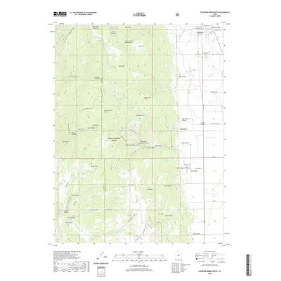
2020 Map of Fountain Green South
USGS Topo · Published 2020About this map
The eastern slopes of the San Pitch Mountains descend into the fertile Sanpete Valley on this modern survey of the region south of Fountain Green. The landscape is defined by the sharp transition from the protected woodlands of the Uinta National Forest to the agricultural grid of the valley floor. Small rural settlements like Freedom and Jerusalem are situated along the valley margin, where canyons such as Maple Canyon and Box Canyon emerge from the high ridges. This map traces a complex network of seasonal water sources and springs, including Minnie Spring and Joe Spring, which have historically sustained ranching in the North Flat and South Flat areas. Evidence of local history is found in the location of the Freedom Cem and the naming of remote landmarks like Devils Gate and Death Hollow.
Find a feature on this map
78 named features on this map. Tap any name to fly to it.
Don’t see what you’re looking for? This feature index may not catch every label — zoom into the map to look around manually.
Map Details
Editions of this 2020 Fountain Green South Map
This is the sole edition of this map. No revisions or reprints were ever made.
Other maps of this area

1885 · Manti
USGS Topo · 1:250,000

1895 · Manti
USGS Topo · 1:250,000

1951 · Moroni
USGS Topo · 1:62,500

1951 · Nephi
USGS Topo · 1:62,500

1956 · Price
USGS Topo · 1:250,000

1960 · Price
USGS Topo · 1:250,000

1962 · Price
USGS Topo · 1:250,000

1965 · Chriss Canyon
USGS Topo · 1:24,000

1965 · Wales
USGS Topo · 1:24,000

1966 · Chester
USGS Topo · 1:24,000