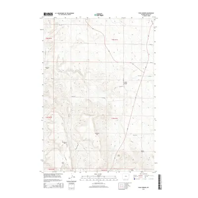
2015 Map of Four Corners
USGS Topo · Published 2015About this map
Four Corners serves as the focal point of this Weston County landscape, where the high plains meet the intricate drainage systems of the Black Hills foothills. The terrain is defined by dramatic elevation changes, ranging from the prominent summit of Sweetwater Mtn and the stark profile of Red Butte to the deep incisions of Horsethief Canyon. This 2015 survey reveals a sparse network of ranching and access roads, such as Skull Creek Rd and Ertman Rd, which navigate around significant plateaus like Northwestern Table. The hydrology is equally complex, with seasonal watercourses including Oil Cr, Red Cr, and Sweetwater Cr carving paths through the high Canyon Springs Prairie. These features collectively illustrate the rugged ranching environment of northeast Wyoming.
Find a feature on this map
31 named features on this map. Tap any name to fly to it.
Don’t see what you’re looking for? This feature index may not catch every label — zoom into the map to look around manually.
Map Details
Editions of this 2015 Four Corners Map
This is the sole edition of this map. No revisions or reprints were ever made.
Other maps of this area

1898 · Sundance
USGS Topo · 1:125,000

1899 · Newcastle
USGS Topo · 1:125,000

1901 · Newcastle
USGS Topo · 1:125,000

1902 · Sundance
USGS Topo · 1:125,000

1954 · Gillette
USGS Topo · 1:250,000

1955 · Newcastle
USGS Topo · 1:250,000

1955 · Gillette
USGS Topo · 1:250,000

1958 · Gillette
USGS Topo · 1:250,000

1958 · Newcastle
USGS Topo · 1:250,000
1958 · Four Corners
USGS Topo · 1:62,500