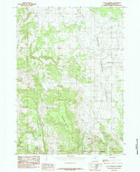
1984 Map of Four Corners
USGS Topo · Published 1984About this map
The high plateau of Canyon Springs Prairie dominates this section of Weston County, providing a stark contrast to the deeply etched drainages that define the surrounding terrain. In the early 1980s, the small settlement of Four Corners served as the primary landmark for this corner of the Black Hills region, situated near a Radio Tower on the level upland. The geography is characterized by significant topographic shifts, moving from the open flats of the Northwestern Table to prominent rises like Sweetwater Mountain and Mt Pisgah.
Find a feature on this map
18 named features on this map. Tap any name to fly to it.
Don’t see what you’re looking for? This feature index may not catch every label — zoom into the map to look around manually.
Map Details
Editions of this 1984 Four Corners Map
This is the sole edition of this map. No revisions or reprints were ever made.
Other maps of this area

1898 · Sundance
USGS Topo · 1:125,000

1899 · Newcastle
USGS Topo · 1:125,000

1901 · Newcastle
USGS Topo · 1:125,000

1902 · Sundance
USGS Topo · 1:125,000

1954 · Gillette
USGS Topo · 1:250,000

1955 · Newcastle
USGS Topo · 1:250,000

1955 · Gillette
USGS Topo · 1:250,000

1958 · Gillette
USGS Topo · 1:250,000

1958 · Newcastle
USGS Topo · 1:250,000
1958 · Four Corners
USGS Topo · 1:62,500