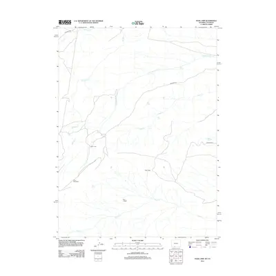
2012 Map of Four J Rim
USGS Topo · Published 2012About this map
Wallace Cabin stands as a solitary named structure in this high-desert landscape, situated along the N Fork Vermillion Cr in southern Sweetwater County. The terrain is defined by the massive uplift of Pine Mountain and the distinct topographical break of the Four J Rim, which overlooks the expansive Four J Basin to the south. This 2012 survey illustrates a sparse but critical water network, where isolated points like Bell Spring, Goat Spring, and Horseshoe Spring provide rare perennial resources. Bureau of Land Management routes, including BLM Road 4413 and BLM Road 4414, weave through the drainage systems of Salt Wells Cr and Coyote Cr, tracing the modern access points into this remote region of the Wyoming-Colorado borderlands.
Find a feature on this map
19 named features on this map. Tap any name to fly to it.
Don’t see what you’re looking for? This feature index may not catch every label — zoom into the map to look around manually.
Map Details
Editions of this 2012 Four J Rim Map
This is the sole edition of this map. No revisions or reprints were ever made.
Other maps of this area

1885 · Ashley
USGS Topo · 1:250,000

1952 · Willow Creek Butte
USGS Topo · 1:24,000

1954 · Vernal
USGS Topo · 1:250,000

1954 · Rock Springs
USGS Topo · 1:250,000

1958 · Vernal
USGS Topo · 1:250,000

1958 · Rock Springs
USGS Topo · 1:250,000

1960 · Vernal
USGS Topo · 1:250,000

1962 · Rock Springs
USGS Topo · 1:250,000
1963 · Titsworth Gap
USGS Topo · 1:24,000

1963 · Four J Rim
USGS Topo · 1:24,000