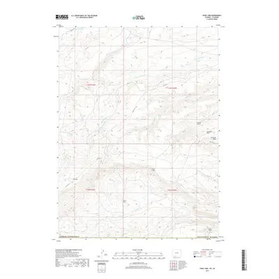
2017 Map of Four J Rim
USGS Topo · Published 2017About this map
Four J Rim and the surrounding high-desert plateau of Sweetwater County define this corner of southwestern Wyoming as it appeared in 2017. The landscape is characterized by a network of drainage systems and intermittent water sources, where Salt Wells Cr and N Fork Vermillion Cr carve through the arid terrain. Isolated water points like Goat Spring, Bell Spring, and Horseshoe Spring emphasize the vital importance of reliable water in this livestock-grazing and resource-extraction region.
Find a feature on this map
28 named features on this map. Tap any name to fly to it.
Don’t see what you’re looking for? This feature index may not catch every label — zoom into the map to look around manually.
Map Details
Editions of this 2017 Four J Rim Map
This is the sole edition of this map. No revisions or reprints were ever made.
Other maps of this area

1885 · Ashley
USGS Topo · 1:250,000

1952 · Willow Creek Butte
USGS Topo · 1:24,000

1954 · Vernal
USGS Topo · 1:250,000

1954 · Rock Springs
USGS Topo · 1:250,000

1958 · Vernal
USGS Topo · 1:250,000

1958 · Rock Springs
USGS Topo · 1:250,000

1960 · Vernal
USGS Topo · 1:250,000

1962 · Rock Springs
USGS Topo · 1:250,000
1963 · Titsworth Gap
USGS Topo · 1:24,000

1963 · Four J Rim
USGS Topo · 1:24,000