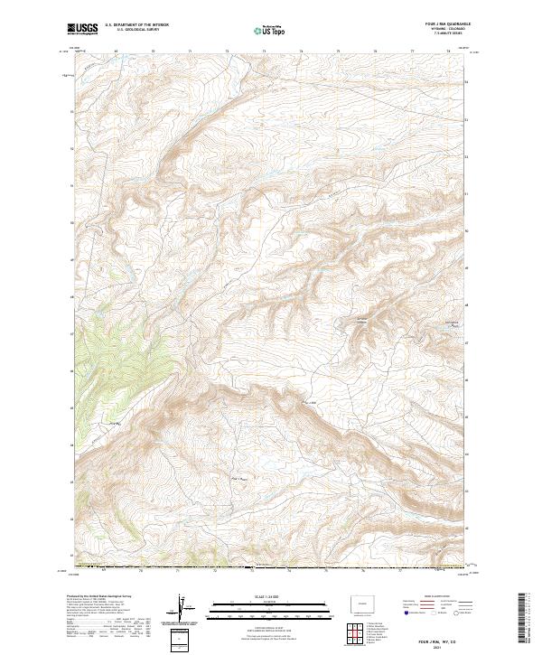
2021 Map of Four J Rim
USGS Topo · Published 2021About this map
Four J Rim defines the central topography of this high-desert landscape in Sweetwater County, where water sources are the primary indicators of life and activity. The presence of numerous named springs, such as Bell Spring, Goat Spring, and Horseshoe Spring, suggests the critical importance of these reliable watering holes for range management and wildlife. The drainage patterns of Salt Wells Creek and Canyon Creek carve through the basin and range, while Pine Mountain and Scrivner Canyon offer significant elevation changes. Access to this remote area is documented via several Bureau of Land Management routes, including BLM RD 4413, which traverses the high ground near Pine Lake. This survey illustrates the intricate relationship between the arid Four J Basin and the vital, isolated water features that sustain it.
Find a feature on this map
28 named features on this map. Tap any name to fly to it.
Don’t see what you’re looking for? This feature index may not catch every label — zoom into the map to look around manually.
Map Details
Editions of this 2021 Four J Rim Map
This is the sole edition of this map. No revisions or reprints were ever made.
Other maps of this area

1885 · Ashley
USGS Topo · 1:250,000

1952 · Willow Creek Butte
USGS Topo · 1:24,000

1954 · Vernal
USGS Topo · 1:250,000

1954 · Rock Springs
USGS Topo · 1:250,000

1958 · Vernal
USGS Topo · 1:250,000

1958 · Rock Springs
USGS Topo · 1:250,000

1960 · Vernal
USGS Topo · 1:250,000

1962 · Rock Springs
USGS Topo · 1:250,000
1963 · Titsworth Gap
USGS Topo · 1:24,000

1963 · Four J Rim
USGS Topo · 1:24,000