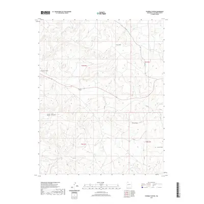
2020 Map of Fourmile Canyon
USGS Topo · Published 2020About this map
Gobernador Canyon and Fourmile Canyon define this section of Rio Arriba County, where the high desert landscape is deeply incised by drainages and flanked by prominent plateaus. The map shows a network of local roads, such as Co RD 362 and Co RD 494, traversing the terrain between large landforms like Frances Mesa and Fourmile Mesa. These mesas rise above the surrounding canyons, providing distinct geographic boundaries for the townships and ranges of northern New Mexico. The presence of Devils Spring Mesa and Encierro Canyon illustrates the traditional Spanish-influenced toponymy of the region. While primarily a landscape of natural features and rural routes, the map detail allows for the precise location of drainage basins like Frances Cr and the complex topography that has shaped land use and movement in this part of the state for generations.
Find a feature on this map
19 named features on this map. Tap any name to fly to it.
Don’t see what you’re looking for? This feature index may not catch every label — zoom into the map to look around manually.
Map Details
Editions of this 2020 Fourmile Canyon Map
This is the sole edition of this map. No revisions or reprints were ever made.
Other maps of this area

1889 · Largo
USGS Topo · 1:250,000

1895 · Largo
USGS Topo · 1:250,000

1954 · Pine River
USGS Topo · 1:24,000

1954 · Gomez Ranch
USGS Topo · 1:24,000

1954 · Aztec
USGS Topo · 1:250,000

1958 · Aztec
USGS Topo · 1:250,000

1959 · Gould Pass
USGS Topo · 1:62,500

1959 · Navajo Dam
USGS Topo · 1:62,500

1962 · Aztec
USGS Topo · 1:250,000

1963 · Fourmile Canyon
USGS Topo · 1:24,000