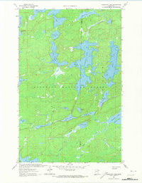
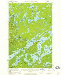
1963 Map of Fourtown Lake
USGS Topo · Published 1974About this map
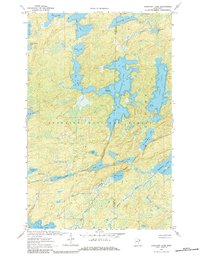
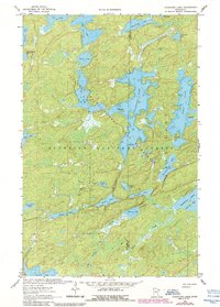
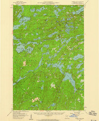
Superior National Forest encompasses the entirety of this northern landscape, which is defined by an intricate network of interconnected waterways and portage routes. Central to the area is the expansive Fourtown Lake, which serves as a hub for several smaller bodies of water including Boot Lake, Fairy Lake, and the distinctly named Tin Can Mike Lake. The mapping, based on 1959 aerial photography and 1963 field checks, highlights a remote wilderness characterized by its glacial geology.
Find a feature on this map
31 named features on this map. Tap any name to fly to it.
Don’t see what you’re looking for? This feature index may not catch every label — zoom into the map to look around manually.
Map Details
Editions of this 1963 Fourtown Lake Map
4 editions found
Other maps of this area

1933 · Ely
USGS Topo · 1:62,500

1939 · Ely
USGS Topo · 1:62,500

1954 · Two Harbors
USGS Topo · 1:250,000

1957 · Two Harbors
USGS Topo · 1:250,000
1957 · Gabbro Lake
USGS Topo · 1:62,500
1957 · Basswood Lake
USGS Topo · 1:62,500
1957 · Quetico
USGS Topo · 1:250,000

1958 · Two Harbors
USGS Topo · 1:250,000
1963 · Fourtown Lake
USGS Topo · 1:24,000
1963 · Angleworm Lake
USGS Topo · 1:24,000