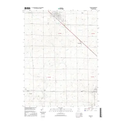
2016 Map of Fowler
USGS Topo · Published 2016About this map
Fowler serves as the focal point of this Benton County landscape, where the grid of the town center transitions into a vast agricultural network of section lines and drainage ditches. The map illustrates a series of small rural communities and railroad stops including Swanington, Chase, and Fargo, which are connected by a diagonal transport corridor cutting across the prairie. The importance of local genealogy is highlighted by several family and town burial grounds, such as Perigo Cem, Oxford Cem, and Boswell Cem, which provide specific points of interest for historical research. Water management is a defining characteristic of the terrain, with features like Humbert Ditch, Wattles Ditch, and Seamans Ditch carefully engineered to support the surrounding farmland, while natural watercourses like Mud Pine Creek wind through the southern sections near Oxford.
Find a feature on this map
52 named features on this map. Tap any name to fly to it.
Don’t see what you’re looking for? This feature index may not catch every label — zoom into the map to look around manually.
Map Details
Editions of this 2016 Fowler Map
This is the sole edition of this map. No revisions or reprints were ever made.
Other maps of this area

1953 · Danville
USGS Topo · 1:250,000

1955 · Danville
USGS Topo · 1:250,000

1956 · Danville
USGS Topo · 1:250,000

1961 · Chatterton
USGS Topo · 1:24,000

1961 · Tab
USGS Topo · 1:24,000

1961 · Pine Village
USGS Topo · 1:24,000

1962 · Mount Gilboa
USGS Topo · 1:24,000

1962 · Wadena
USGS Topo · 1:24,000

1962 · Templeton
USGS Topo · 1:24,000

1962 · Boswell
USGS Topo · 1:24,000