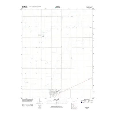
2010 Map of Fowler
USGS Topo · Published 2010About this map
Crooked Creek meanders through the landscape of Meade County, defining the drainage patterns of this section of the Artesian Valley. The city of Fowler serves as the primary hub of activity, with its residential grid structured around Main St, Walnut St, and 4th St. This 2010 survey by the U.S. Geological Survey shows the town as it transitions into the rural surroundings, supported by the nearby Fowler Airport. Outside the town center, the map reveals a meticulously surveyed agricultural landscape marked by a strict grid of county roads. Genealogists and local historians will find value in the specific locations of the Wilburn Cemetery in the northeast and the McCauley Cemetery further west, both providing vital markers of the area's early settlement history.
Find a feature on this map
24 named features on this map. Tap any name to fly to it.
Don’t see what you’re looking for? This feature index may not catch every label — zoom into the map to look around manually.
Map Details
Editions of this 2010 Fowler Map
This is the sole edition of this map. No revisions or reprints were ever made.
Other maps of this area

1892 · Meade
USGS Topo · 1:125,000

1892 · Dodge
USGS Topo · 1:125,000

1955 · Dodge City
USGS Topo · 1:250,000

1958 · Dodge City
USGS Topo · 1:250,000

1959 · Dodge City
USGS Topo · 1:250,000

1963 · Meade
USGS Topo · 1:24,000

1967 · Fowler SE
USGS Topo · 1:24,000

1967 · Fowler SW
USGS Topo · 1:24,000

1967 · Minneola
USGS Topo · 1:24,000

1969 · Meade NE
USGS Topo · 1:24,000