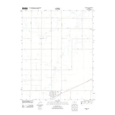
2012 Map of Fowler
USGS Topo · Published 2012About this map
Crooked Cr meanders across this rural Meade County landscape, defining the hydrology of the High Plains near the settlement of Fowler. The map reflects a classic western Kansas grid of section roads, including J J RD and Yucca Rd, that organize the agricultural terrain. Genealogical interest is anchored by the Wilburn Cem in the northeast and McCauley Cem further west, both situated along rural roads far from the main town center. Within Fowler itself, the layout of the community is detailed along Maple St and Kansas St, featuring a local Po and the nearby Fowler Airport. The alignment of Old Highway 54 cuts diagonally across the southern portion of the quadrangle, representing the primary transportation artery for the region in the early 21st century.
Find a feature on this map
25 named features on this map. Tap any name to fly to it.
Don’t see what you’re looking for? This feature index may not catch every label — zoom into the map to look around manually.
Map Details
Editions of this 2012 Fowler Map
This is the sole edition of this map. No revisions or reprints were ever made.
Other maps of this area

1892 · Meade
USGS Topo · 1:125,000

1892 · Dodge
USGS Topo · 1:125,000

1955 · Dodge City
USGS Topo · 1:250,000

1958 · Dodge City
USGS Topo · 1:250,000

1959 · Dodge City
USGS Topo · 1:250,000

1963 · Meade
USGS Topo · 1:24,000

1967 · Fowler SE
USGS Topo · 1:24,000

1967 · Fowler SW
USGS Topo · 1:24,000

1967 · Minneola
USGS Topo · 1:24,000

1969 · Meade NE
USGS Topo · 1:24,000