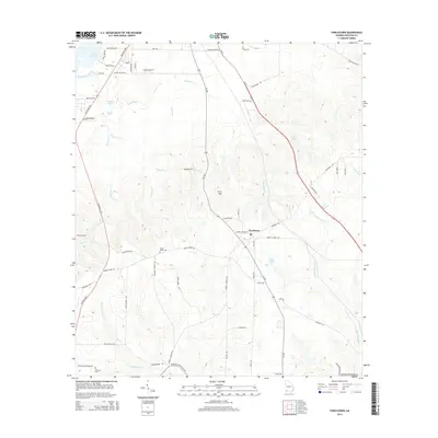
2014 Map of Fowlstown
USGS Topo · Published 2014About this map
Fowlstown serves as a central hub in this corner of Decatur County, where the landscape is defined by an intricate network of creeks and drainage basins. To the west, the waters of Lake Seminole and Turkey Trail Branch feed into a series of smaller water bodies including Fountain Pond and Duck Pond. The terrain rises toward Curry Hill and is bisected by several significant watercourses like Spring Creek, Willacoochee Creek, and Little Attapulgus Creek. Local history is preserved in the placement of Green Shade Cemetery and Peterson Cemetery, which sit alongside historic transit corridors such as the Faceville Highway and Ga-309. This survey captures the rural character of the region, where numerous named branches and family-named roads like Crawford Road and Youmans Road crisscross the agricultural and wooded lands south of Bainbridge.
Find a feature on this map
68 named features on this map. Tap any name to fly to it.
Don’t see what you’re looking for? This feature index may not catch every label — zoom into the map to look around manually.
Map Details
Editions of this 2014 Fowlstown Map
This is the sole edition of this map. No revisions or reprints were ever made.
Other maps of this area

1954 · Tallahassee
USGS Topo · 1:250,000

1955 · Bainbridge
USGS Topo · 1:62,500

1955 · Whigham
USGS Topo · 1:62,500

1955 · Mt Pleasant
USGS Topo · 1:24,000

1956 · Havana North
USGS Topo · 1:24,000

1956 · Dogtown
USGS Topo · 1:24,000

1959 · Tallahassee
USGS Topo · 1:250,000

1960 · Tallahassee
USGS Topo · 1:250,000
1974 · Bainbridge
USGS Topo · 1:24,000
1974 · Faceville
USGS Topo · 1:24,000