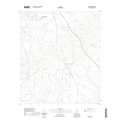
2020 Map of Fowlstown
USGS Topo · Published 2020About this map
Bainbridge sits at the northern edge of this Decatur County landscape, where residential expansion meets the dense wetlands and hydrologic networks of the Florida-Georgia borderlands. The terrain is defined by its abundant water features, ranging from the expansive Lake Seminole in the northwest to the interior depths of Fowlstown Swamp and Rich Lake. A complex system of creeks, including Ginhouse Creek, Spring Creek, and Little Attapulgus Creek, drains the rolling landscape around Curry Hill. Local history is anchored by the settlement of Fowlstown and the presence of rural burial grounds like Green Shade Cemetery and Peterson Cemetery. The map captures a transition from suburban street grids near the city to the long, rural corridors of Tallahassee Road and Fowlstown Road, reflecting the area's agricultural character and the natural barrier of the Willa-coochee Creek basin to the south.
Find a feature on this map
71 named features on this map. Tap any name to fly to it.
Don’t see what you’re looking for? This feature index may not catch every label — zoom into the map to look around manually.
Map Details
Editions of this 2020 Fowlstown Map
This is the sole edition of this map. No revisions or reprints were ever made.
Other maps of this area

1954 · Tallahassee
USGS Topo · 1:250,000

1955 · Bainbridge
USGS Topo · 1:62,500

1955 · Whigham
USGS Topo · 1:62,500

1955 · Mt Pleasant
USGS Topo · 1:24,000

1956 · Havana North
USGS Topo · 1:24,000

1956 · Dogtown
USGS Topo · 1:24,000

1959 · Tallahassee
USGS Topo · 1:250,000

1960 · Tallahassee
USGS Topo · 1:250,000
1974 · Bainbridge
USGS Topo · 1:24,000
1974 · Faceville
USGS Topo · 1:24,000