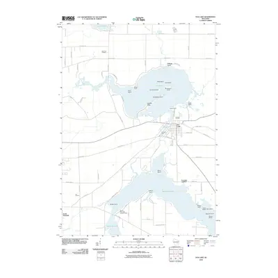
2010 Map of Fox Lake
USGS Topo · Published 2010About this map
Fox Lake and its intricate shoreline of points and islands dominate this central Wisconsin landscape at the start of the 21st century. The map details a transition from the compact settlement of Fox Lake to the scattered lakeside communities of Delbern Acres and Lyndon Dale. To the south, the waters of Beaver Dam Lake reach into the quadrangle, punctuated by Bedker Island and the Beaver Dam Lake Seaplane Base.
Find a feature on this map
71 named features on this map. Tap any name to fly to it.
Don’t see what you’re looking for? This feature index may not catch every label — zoom into the map to look around manually.
Map Details
Editions of this 2010 Fox Lake Map
This is the sole edition of this map. No revisions or reprints were ever made.
Other maps of this area

1955 · Randolph
USGS Topo · 1:62,500

1955 · Columbus
USGS Topo · 1:62,500

1955 · Beaver Dam
USGS Topo · 1:62,500

1955 · Fox Lake
USGS Topo · 1:62,500

1957 · Madison
USGS Topo · 1:250,000

1960 · Madison
USGS Topo · 1:250,000

1975 · Beaver Dam NE
USGS Topo · 1:24,000

1980 · Fond Du Lac
USGS Topo · 1:100,000

1980 · Lost Lake
USGS Topo · 1:24,000
1980 · Brandon
USGS Topo · 1:24,000