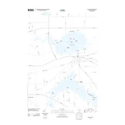
2013 Map of Fox Lake
USGS Topo · Published 2013About this map
Fox Lake dominates the upper half of this Dodge County landscape, characterized by a complex shoreline and a dense archipelago including Elmwood Island, Devil Island, and McFetridge Island. The city of Fox Lake sits on the southern shore, serving as a hub where Wi-68 and State Road 33 converge. Further south, the map reveals a transition into the northern reaches of Beaver Dam Lake, with the Trestle Works industrial site and the Fox Lake Junction rail area marking the historical transportation corridor between these two major water bodies.
Find a feature on this map
88 named features on this map. Tap any name to fly to it.
Don’t see what you’re looking for? This feature index may not catch every label — zoom into the map to look around manually.
Map Details
Editions of this 2013 Fox Lake Map
This is the sole edition of this map. No revisions or reprints were ever made.
Other maps of this area

1955 · Randolph
USGS Topo · 1:62,500

1955 · Columbus
USGS Topo · 1:62,500

1955 · Beaver Dam
USGS Topo · 1:62,500

1955 · Fox Lake
USGS Topo · 1:62,500

1957 · Madison
USGS Topo · 1:250,000

1960 · Madison
USGS Topo · 1:250,000

1975 · Beaver Dam NE
USGS Topo · 1:24,000

1980 · Fond Du Lac
USGS Topo · 1:100,000

1980 · Lost Lake
USGS Topo · 1:24,000
1980 · Brandon
USGS Topo · 1:24,000