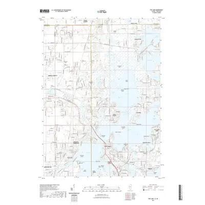
2021 Map of Fox Lake
USGS Topo · Published 2021About this map
Grass Lake and the complex waterways of the Chain-O-Lakes State Park dominate this landscape on the Illinois-Wisconsin border. The map documents a dense network of interconnected basins including Pistakee Lake, Nippersink Lake, and Channel Lake, reflecting the region's long-standing character as a premier midwestern water retreat. High ground like Gander Mtn and Bald Knob rises above the lowlands, providing contrast to the numerous islands such as Grass Island and Hackberry Island. Local history and genealogy interest is concentrated in several burial grounds like Orvis-Sanborn Cem and Saint Bede Catholic Cem. The map also details small aviation sites including Midland Airport and Pillow Hill Airport, alongside established lakefront communities from Twin Lakes to Fox Lake.
Find a feature on this map
71 named features on this map. Tap any name to fly to it.
Don’t see what you’re looking for? This feature index may not catch every label — zoom into the map to look around manually.
Map Details
Editions of this 2021 Fox Lake Map
This is the sole edition of this map. No revisions or reprints were ever made.
Other maps of this area

1893 · Silver Lake
USGS Topo · 1:62,500

1893 · Geneva
USGS Topo · 1:62,500

1904 · Lake Geneva
USGS Topo · 1:62,500

1906 · Silver Lake
USGS Topo · 1:62,500

1906 · Lake Geneva
USGS Topo · 1:62,500

1920 · Grays Lake
USGS Topo · 1:62,500

1923 · Grays Lake
USGS Topo · 1:62,500

1926 · Mc Henry
USGS Topo · 1:62,500

1944 · McHenry
USGS Topo · 1:62,500

1954 · Rockford
USGS Topo · 1:250,000