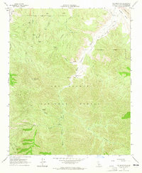
1964 Map of Fox Mountain
USGS Topo · Published 1965About this map
Los Padres National Forest dominates this mid-1960s survey, capturing a remote landscape of the Sierra Madre Mts defined by deep drainage systems and seasonal water sources. The map centers on the high point of Fox Mountain and the complex network of canyons that feed the Cuyama River, including Santa Barbara Canyon and Dry Canyon. This period shows the limited human imprint on the backcountry, primarily represented by small-scale ranching and primitive access routes.
Find a feature on this map
30 named features on this map. Tap any name to fly to it.
Don’t see what you’re looking for? This feature index may not catch every label — zoom into the map to look around manually.
Map Details
Editions of this 1964 Fox Mountain Map
3 editions found
Other maps of this area

1902 · Santa Ynez
USGS Topo · 1:125,000

1903 · Mt. Pinos
USGS Topo · 1:125,000

1905 · Santa Ynez
USGS Topo · 1:125,000

1942 · Ballinger Canyon
USGS Topo · 1:24,000

1942 · East of Cuyama Ranch
USGS Topo · 1:24,000

1943 · Big Pine Mountain
USGS Topo · 1:31,680

1943 · Cuyama Ranch
USGS Topo · 1:31,680

1943 · Rancho Nuevo Creek
USGS Topo · 1:24,000
1943 · Ballinger Canyon
USGS Topo · 1:24,000

1943 · Cuyama Peak
USGS Topo · 1:24,000