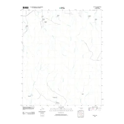
2009 Map of Fox NE
USGS Topo · Published 2009About this map
Hennepin Cemetery and the secluded settlement of Thomas Hollow anchor this rural Oklahoma landscape, which is defined by a sophisticated network of watershed management structures. The terrain is marked by numerous flood control impoundments including Wildhorse Creek Site 125 Dam, Zelder Humble Lake Number 2 Dam, and Banks Humble Lake Number 1 Dam. These engineering features reflect the mid-to-late 20th-century emphasis on soil conservation and water management in the southern plains.
Find a feature on this map
25 named features on this map. Tap any name to fly to it.
Don’t see what you’re looking for? This feature index may not catch every label — zoom into the map to look around manually.
Map Details
Editions of this 2009 Fox NE Map
This is the sole edition of this map. No revisions or reprints were ever made.
Other maps of this area

1898 · Pauls Valley
USGS Topo · 1:125,000

1901 · Ardmore
USGS Topo · 1:125,000

1902 · Pauls Valley
USGS Topo · 1:125,000

1918 · Ardmore
USGS Topo · 1:125,000

1957 · Ardmore
USGS Topo · 1:250,000

1963 · Ardmore
USGS Topo · 1:250,000

1964 · Springer
USGS Topo · 1:24,000

1964 · Turner Falls
USGS Topo · 1:24,000

1965 · Joy
USGS Topo · 1:24,000

1968 · Fox NE
USGS Topo · 1:24,000