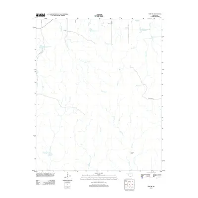
2012 Map of Fox NE
USGS Topo · Published 2012About this map
Hennepin Cem sits in the northern reaches of this Oklahoma landscape, serving as a primary point of interest for genealogists and local historians. The area is defined by a complex network of water management, illustrated by numerous numbered impoundments including Wildhorse Creek Site 9 Reservoir and Wildhorse Creek Site 7 Reservoir. This reliance on watershed sites indicates a focus on soil conservation and flood control within the rural topography. Ranching culture is evident through named thoroughfares such as Sparks Ranch Rd and Zellner Ranch Rd. The drainage pattern is highly detailed, featuring named tributaries like Eightmile Cr, Fivemile Cr, and Squirrel Cr that converge across the terrain, while Thomas Hollow marks a distinct geographic feature in the southeast near Thomas Cr.
Find a feature on this map
23 named features on this map. Tap any name to fly to it.
Don’t see what you’re looking for? This feature index may not catch every label — zoom into the map to look around manually.
Map Details
Editions of this 2012 Fox NE Map
This is the sole edition of this map. No revisions or reprints were ever made.
Other maps of this area

1898 · Pauls Valley
USGS Topo · 1:125,000

1901 · Ardmore
USGS Topo · 1:125,000

1902 · Pauls Valley
USGS Topo · 1:125,000

1918 · Ardmore
USGS Topo · 1:125,000

1957 · Ardmore
USGS Topo · 1:250,000

1963 · Ardmore
USGS Topo · 1:250,000

1964 · Springer
USGS Topo · 1:24,000

1964 · Turner Falls
USGS Topo · 1:24,000

1965 · Joy
USGS Topo · 1:24,000

1968 · Fox NE
USGS Topo · 1:24,000