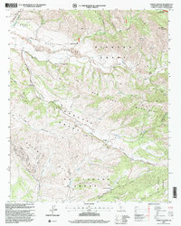
1995 Map of Foxen Canyon
USGS Topo · Published 2000About this map
Large Mexican land grants define the northern Santa Barbara County landscape in this mid-1990s revision of a mid-century topographic study. The area is dominated by the Tinaquaic Grant, Sisquoc Grant, and La Laguna (Gutierrez) Grant, reflecting the region’s deep ranching history. Along Foxen Canyon Road, family and local history is anchored by the Foxen Adobe (Site), the Fremont Foxen Monument, and the Foxen Canyon Cem. These markers signify the 19th-century settlement era when William Benjamin Foxen established his holdings here.
Find a feature on this map
39 named features on this map. Tap any name to fly to it.
Don’t see what you’re looking for? This feature index may not catch every label — zoom into the map to look around manually.
Map Details
Editions of this 1995 Foxen Canyon Map
This is the sole edition of this map. No revisions or reprints were ever made.
Other maps of this area

1905 · Lompoc
USGS Topo · 1:125,000

1942 · Lompoc
USGS Topo · 1:125,000

1942 · Lompoc
USGS Topo · 1:62,500

1942 · Santa Maria
USGS Topo · 1:62,500

1942 · Tepusquet Peak
USGS Topo · 1:62,500

1942 · Los Olivos
USGS Topo · 1:62,500

1943 · Los Olivos
USGS Topo · 1:62,500

1943 · Tepusquet Peak
USGS Topo · 1:62,500

1943 · Lompoc
USGS Topo · 1:125,000

1947 · Careaga Canyon
USGS Topo · 1:24,000