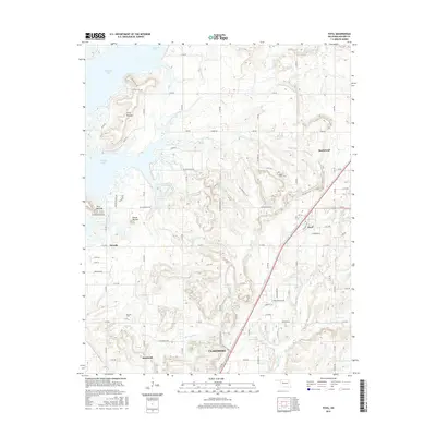
2016 Map of Foyil
USGS Topo · Published 2016About this map
Oologah Lake dominates the northwest corner of this Rogers County landscape, where the prairie meets the wooded hills of northeast Oklahoma. The map documents the northern edge of Claremore and the smaller settlements of Foyil, Bushyhead, Oowala, and Sequoyah. Distinctive geological features rise above the surrounding terrain, including Twin Mounds, Round Mound, and Long Mound, providing clear landmarks for local history and topography. Several streams, such as Sweetwater Cr, Blue Cr, and Dog Cr, wind through the area, defining the drainage patterns toward the reservoir. For genealogists and local historians, the locations of Oowala Cem and Wards Grove Cem provide important reference points for family research. The map also traces the modern road network, including the diagonal path of the main highway and rail corridor through Foyil, which has historically served as a central transit point in the region.
Find a feature on this map
75 named features on this map. Tap any name to fly to it.
Don’t see what you’re looking for? This feature index may not catch every label — zoom into the map to look around manually.
Map Details
Editions of this 2016 Foyil Map
This is the sole edition of this map. No revisions or reprints were ever made.
Other maps of this area

1896 · Pryor
USGS Topo · 1:125,000

1901 · Claremore
USGS Topo · 1:125,000

1901 · Nowata
USGS Topo · 1:125,000

1901 · Vinita
USGS Topo · 1:125,000

1901 · Pryor
USGS Topo · 1:125,000

1913 · Vinita
USGS Topo · 1:125,000

1914 · Nowata
USGS Topo · 1:125,000

1914 · Claremore
USGS Topo · 1:125,000

1916 · Claremore
USGS Topo · 1:125,000

1954 · Tulsa
USGS Topo · 1:250,000