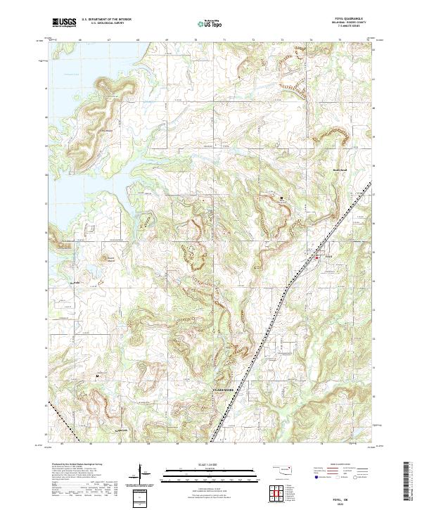
2022 Map of Foyil
USGS Topo · Published 2022About this map
Oologah Lake dominates the northwest corner of this Rogers County landscape, where the waters meet the elevated terrain of the Coyote Hills. The area is characterized by several prominent landmarks, including Long Mound, Round Mound, and Twin Mounds, which provide distinct topographic relief to the east of the lake. Small communities such as Foyil, Bushyhead, and Oowala are distributed along a north-south corridor, with Claremore appearing at the southern edge of the survey. Significant local sites for genealogical research include Wards Grove Cem and Oowala Cem. The hydrological network is defined by Blue Cr and the winding course of Dog Creek, which flows through the southern half of the quadrangle near the community of Sequoyah.
Find a feature on this map
52 named features on this map. Tap any name to fly to it.
Don’t see what you’re looking for? This feature index may not catch every label — zoom into the map to look around manually.
Map Details
Editions of this 2022 Foyil Map
This is the sole edition of this map. No revisions or reprints were ever made.
Other maps of this area

1896 · Pryor
USGS Topo · 1:125,000

1901 · Claremore
USGS Topo · 1:125,000

1901 · Nowata
USGS Topo · 1:125,000

1901 · Vinita
USGS Topo · 1:125,000

1901 · Pryor
USGS Topo · 1:125,000

1913 · Vinita
USGS Topo · 1:125,000

1914 · Nowata
USGS Topo · 1:125,000

1914 · Claremore
USGS Topo · 1:125,000

1916 · Claremore
USGS Topo · 1:125,000

1954 · Tulsa
USGS Topo · 1:250,000