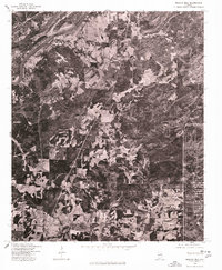
1975 Map of Francis Mill
USGS Topo · Published 1977About this map
Coosa River frontage and the upland woods of Calhoun County define this 1975 orthophotoquad, which captures the landscape via aerial photography instead of traditional topographic contours. The terrain is characterized by a patchwork of cleared agricultural fields and dense forest tracts, showing the rural character of the area in the mid-1970s. The settlement at Francis Mill serves as the primary named landmark, situated among a network of rural roads that cross the rolling northern Alabama countryside. Produced in cooperation with the Soil Conservation Service, this imagery documents land use patterns and field boundaries precisely as they existed on December 2, 1975. This specific type of survey is valuable for identifying property lines and vegetation cover that are often generalized on standard line maps.
Find a feature on this map
2 named features on this map. Tap any name to fly to it.
Don’t see what you’re looking for? This feature index may not catch every label — zoom into the map to look around manually.
Map Details
Editions of this 1975 Francis Mill Map
This is the sole edition of this map. No revisions or reprints were ever made.
Other maps of this area

1889 · Springville
USGS Topo · 1:125,000

1892 · Springville
USGS Topo · 1:125,000

1900 · Anniston
USGS Topo · 1:125,000

1947 · Cox Gap
USGS Topo · 1:24,000

1947 · Eastaboga
USGS Topo · 1:24,000

1947 · Ragland
USGS Topo · 1:62,500

1947 · Ragland
USGS Topo · 1:24,000

1947 · Riverside
USGS Topo · 1:24,000

1947 · Wellington
USGS Topo · 1:24,000

1947 · Francis Mill
USGS Topo · 1:24,000