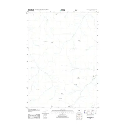
2012 Map of Francs Peak
USGS Topo · Published 2012About this map
Kirwin stands as a focal point in this high-elevation landscape within the Absaroka Range, where mining history and alpine terrain converge. The presence of the Mattice Tunnel near the settlement underscores the area's subterranean industrial legacy, situated at the base of significant heights like Mount Crosby. Drainage patterns are defined by the Greybull River and the Wood River, which carve through deep basins such as Meadow Creek Basin and Brown Basin. High-altitude routes are marked by Greybull Pass, providing a transition between the steep ridges of Galena Ridge and Yellow Ridge. The map details a complex network of glacial and fluvial features, from the remote waters of Jojo Lake to the towering summit of Francs Peak, illustrating the hydrological headwaters that feed the surrounding Wyoming wilderness.
Find a feature on this map
33 named features on this map. Tap any name to fly to it.
Don’t see what you’re looking for? This feature index may not catch every label — zoom into the map to look around manually.
Map Details
Editions of this 2012 Francs Peak Map
This is the sole edition of this map. No revisions or reprints were ever made.
Other maps of this area

1904 · Kirwin
USGS Topo · 1:125,000

1906 · Kirwin
USGS Topo · 1:125,000

1955 · Cody
USGS Topo · 1:250,000

1955 · Thermopolis
USGS Topo · 1:250,000

1957 · Irish Rock
USGS Topo · 1:62,500

1957 · Sunshine Reservoir
USGS Topo · 1:62,500

1958 · Cody
USGS Topo · 1:250,000

1958 · Thermopolis
USGS Topo · 1:250,000

1962 · Thermopolis
USGS Topo · 1:250,000

1962 · Cody
USGS Topo · 1:250,000