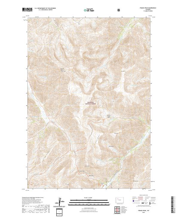
2021 Map of Francs Peak
USGS Topo · Published 2021About this map
Francs Peak stands as the dominant summit in this high-altitude corner of the Shoshone National Forest, marking the crest of the Absaroka Range. The landscape is defined by the headwaters of major drainage systems, including the Greybull River and the Wood River, which have carved deep basins like Brown Basin and Meadow Creek Basin. A network of historic pack trails, such as the Greybull River Trl and Upper Jack Creek Trl, provides the primary means of navigating these steep grades. Evidence of high-country prospecting appears at the Mattice Tunnel near the southern boundary, while the crossing at Greybull Pass illustrates the traditional routes used to traverse these subalpine divides. The presence of Jojo Lake and several smaller spur creeks highlights the complex hydrology of this wilderness area.
Find a feature on this map
44 named features on this map. Tap any name to fly to it.
Don’t see what you’re looking for? This feature index may not catch every label — zoom into the map to look around manually.
Map Details
Editions of this 2021 Francs Peak Map
This is the sole edition of this map. No revisions or reprints were ever made.
Other maps of this area

1904 · Kirwin
USGS Topo · 1:125,000

1906 · Kirwin
USGS Topo · 1:125,000

1955 · Cody
USGS Topo · 1:250,000

1955 · Thermopolis
USGS Topo · 1:250,000

1957 · Irish Rock
USGS Topo · 1:62,500

1957 · Sunshine Reservoir
USGS Topo · 1:62,500

1958 · Cody
USGS Topo · 1:250,000

1958 · Thermopolis
USGS Topo · 1:250,000

1962 · Thermopolis
USGS Topo · 1:250,000

1962 · Cody
USGS Topo · 1:250,000