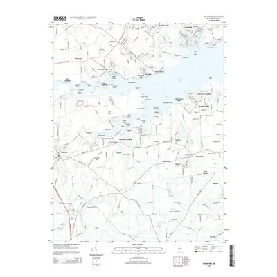
2014 Map of Frankford
USGS Topo · Published 2014About this map
Dagsboro and Frankford serve as the primary inland hubs on the Delmarva Peninsula Eastern Shore, connected by a network of drainage ways and tidal tributaries. The landscape is defined by the intricate reach of Indian River Bay, where numerous points such as Warwick Point and Lingo Point jut into the water, creating sheltered coves like Warwick Cove and Ferry Cove. The map documents a dense pattern of landings along Pepper Creek and Vines Creek, including Thatchers Landing and Helms Landing, which historically facilitated local maritime commerce.
Find a feature on this map
272 named features on this map. Tap any name to fly to it.
Don’t see what you’re looking for? This feature index may not catch every label — zoom into the map to look around manually.
Map Details
Editions of this 2014 Frankford Map
This is the sole edition of this map. No revisions or reprints were ever made.
Other maps of this area

1901 · Ocean City
USGS Topo · 1:62,500

1902 · Pittsville
USGS Topo · 1:62,500

1917 · Millsboro
USGS Topo · 1:62,500

1918 · Rehoboth
USGS Topo · 1:62,500

1938 · Millsboro
USGS Topo · 1:62,500

1938 · Rehoboth
USGS Topo · 1:62,500

1942 · Ocean City
USGS Topo · 1:62,500

1942 · Whaleysville
USGS Topo · 1:24,000

1943 · Selbyville
USGS Topo · 1:31,680
1943 · Whaleysville
USGS Topo · 1:31,680