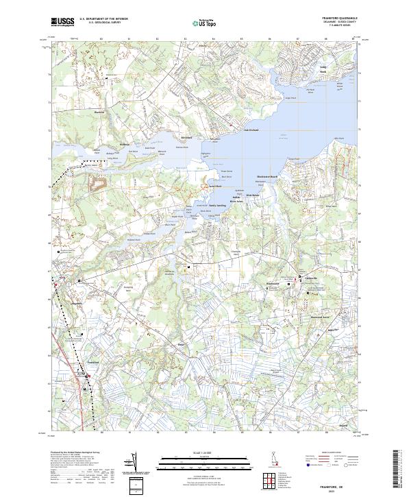
2023 Map of Frankford
USGS Topo · Published 2023About this map
The Indian River Bay and its complex network of tidal guts and points define the landscape of eastern Sussex County. In the inland reaches, the settlements of Frankford, Dagsboro, and Millville anchor the agricultural and residential corridors. This 2023 survey illustrates how family and community histories are preserved through numerous local landmarks, such as the Antioch African Methodist Episcopal Church and the nearby Dagsboro Redmens Memorial Cem.
Find a feature on this map
282 named features on this map. Tap any name to fly to it.
Don’t see what you’re looking for? This feature index may not catch every label — zoom into the map to look around manually.
Map Details
Editions of this 2023 Frankford Map
This is the sole edition of this map. No revisions or reprints were ever made.
Other maps of this area

1901 · Ocean City
USGS Topo · 1:62,500

1902 · Pittsville
USGS Topo · 1:62,500

1917 · Millsboro
USGS Topo · 1:62,500

1918 · Rehoboth
USGS Topo · 1:62,500

1938 · Millsboro
USGS Topo · 1:62,500

1938 · Rehoboth
USGS Topo · 1:62,500

1942 · Ocean City
USGS Topo · 1:62,500

1942 · Whaleysville
USGS Topo · 1:24,000

1943 · Selbyville
USGS Topo · 1:31,680
1943 · Whaleysville
USGS Topo · 1:31,680