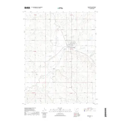
2018 Map of Frankfort
USGS Topo · Published 2018About this map
Frankfort stands as the primary hub in this Marshall County landscape, where the Black Vermillion River winds through the central terrain. This recent survey captures the modern road grid and settlement patterns around the town and the smaller community of Barret. The area is marked by numerous watercourses, including Robidoux Cr, Little Timber Cr, and Dog Walk Cr, which feed into the river system. Genealogists and local historians can find several established burial grounds, such as Calvary Cem and Frankfort Cem near the town center, along with the outlying Wells Cem and Barrett Cem. The map illustrates a transition from the structured street plan of Frankfort to a vast network of rural roads such as Sunflower Rd and Tumbleweed Rd, highlighting the enduring agricultural character of northern Kansas.
Find a feature on this map
35 named features on this map. Tap any name to fly to it.
Don’t see what you’re looking for? This feature index may not catch every label — zoom into the map to look around manually.
Map Details
Editions of this 2018 Frankfort Map
This is the sole edition of this map. No revisions or reprints were ever made.
Other maps of this area

1889 · Seneca
USGS Topo · 1:125,000

1889 · Marysville
USGS Topo · 1:125,000

1894 · Seneca
USGS Topo · 1:125,000

1894 · Marysville
USGS Topo · 1:125,000

1955 · Manhattan
USGS Topo · 1:250,000

1956 · Manhattan
USGS Topo · 1:250,000

1957 · Manhattan
USGS Topo · 1:250,000

1966 · Axtell
USGS Topo · 1:24,000

1966 · Home
USGS Topo · 1:24,000
1966 · Beattie
USGS Topo · 1:24,000