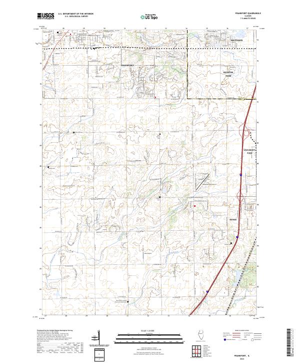
2024 Map of Frankfort
USGS Topo · Published 2024About this map
Frankfort and Monee anchor this modern landscape where Will County's agricultural roots meet expanding suburban development. The drainage patterns of Forked Creek and the South Branch Forked Creek cross the southern half of the quadrangle, while Hickory Creek and Jackson Creek define the northern drainages. This area maintains a high concentration of local history markers, particularly through its numerous burial grounds like Twining Cem, Rose Hill Cem, and Saint John's United Church of Christ Cem. Small-scale aviation is represented by Meadow Creek Airport and Wix Airport, positioned amidst a network of arterial roads including W Monee Manhattan Rd and W Steger Rd. The map documents the boundary between Cook and Will counties, illustrating the transition from the denser settlements of Richton Park and Matteson to the more open lands further south.
Find a feature on this map
46 named features on this map. Tap any name to fly to it.
Don’t see what you’re looking for? This feature index may not catch every label — zoom into the map to look around manually.
Map Details
Editions of this 2024 Frankfort Map
This is the sole edition of this map. No revisions or reprints were ever made.
Other maps of this area

1890 · Des Plaines
USGS Topo · 1:62,500

1892 · Calumet
USGS Topo · 1:62,500

1893 · Calumet
USGS Topo · 1:62,500

1894 · Des Plaines
USGS Topo · 1:62,500

1900 · Des Plaines
USGS Topo · 1:62,500

1900 · Calumet
USGS Topo · 1:62,500

1901 · Calumet
USGS Topo · 1:62,500

1901 · Des Plaines
USGS Topo · 1:62,500

1929 · Tinley Park
USGS Topo · 1:24,000

1929 · Brisbane
USGS Topo · 1:24,000