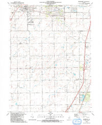
1990 Map of Frankfort
USGS Topo · Published 1991About this map
Frankfort serves as the primary hub in this late-twentieth-century study of Will and Cook Counties, where suburban development meets traditional rural township grids. The Old Indian Boundary line cuts diagonally across the northern landscape, creating a distinct geometric contrast against the straight alignments of Laraway Road and Sauk Trail Road. This surveying artifact reflects the historical frontier boundaries that shaped local land claims and settlement patterns long before the modern residential clusters of Lincoln Estates and Prestwick Country Club emerged.
Find a feature on this map
52 named features on this map. Tap any name to fly to it.
Don’t see what you’re looking for? This feature index may not catch every label — zoom into the map to look around manually.
Map Details
Editions of this 1990 Frankfort Map
This is the sole edition of this map. No revisions or reprints were ever made.
Other maps of this area

1890 · Des Plaines
USGS Topo · 1:62,500

1892 · Calumet
USGS Topo · 1:62,500

1893 · Calumet
USGS Topo · 1:62,500

1894 · Des Plaines
USGS Topo · 1:62,500

1900 · Des Plaines
USGS Topo · 1:62,500

1900 · Calumet
USGS Topo · 1:62,500

1901 · Calumet
USGS Topo · 1:62,500

1901 · Des Plaines
USGS Topo · 1:62,500

1929 · Tinley Park
USGS Topo · 1:24,000

1929 · Brisbane
USGS Topo · 1:24,000