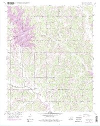
1956 Map of Franklin
USGS Topo · Published 1976About this map
Little River and Rock Creek wind through this mid-century landscape where the border of Oklahoma and Cleveland counties meets. The settlement of Franklin sits central to a network of rural schoolhouses and churches that anchored the local community during this era, including Schwartz Sch, Liberty Sch, and Meeks Chapel.
Find a feature on this map
25 named features on this map. Tap any name to fly to it.
Don’t see what you’re looking for? This feature index may not catch every label — zoom into the map to look around manually.
Map Details
Editions of this 1956 Franklin Map
4 editions found
Other maps of this area

1892 · Moore
USGS Topo · 1:62,500

1893 · Norman
USGS Topo · 1:62,500

1898 · Purcell
USGS Topo · 1:125,000

1910 · McComb
USGS Topo · 1:62,500

1925 · Norman NO 2
USGS Topo · 1:24,000

1930 · McLoud
USGS Topo · 1:62,500

1934 · Crutcho Creek
USGS Topo · 1:24,000

1934 · Moore
USGS Topo · 1:62,500

1936 · Norman
USGS Topo · 1:62,500

1938 · Moore
USGS Topo · 1:62,500