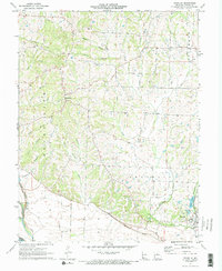
1971 Map of Franklin
USGS Topo · Published 1973About this map
Franklin and Boonesboro anchor this 1970s topographic study of Howard County, Missouri, highlighting the complex drainage patterns and transport networks of the region. The landscape is defined by the Old Missouri River Channel in the southwest, where the floodplain's history is etched into the terrain. Further inland, the Boones Lick area is dissected by numerous waterways including Boones Lick Branch, Salt Creek, and Sulphur Creek.
Find a feature on this map
34 named features on this map. Tap any name to fly to it.
Don’t see what you’re looking for? This feature index may not catch every label — zoom into the map to look around manually.
Map Details
Editions of this 1971 Franklin Map
2 editions found
Other maps of this area

1888 · Boonville
USGS Topo · 1:125,000

1890 · Glasgow
USGS Topo · 1:125,000

1947 · Glasgow
USGS Topo · 1:62,500

1947 · Jefferson City
USGS Topo · 1:250,000

1952 · Boonville
USGS Topo · 1:24,000

1952 · New Franklin
USGS Topo · 1:24,000

1953 · Moberly
USGS Topo · 1:250,000

1953 · Fayette
USGS Topo · 1:24,000

1953 · Billingsville
USGS Topo · 1:24,000

1953 · Pilot Grove North
USGS Topo · 1:24,000