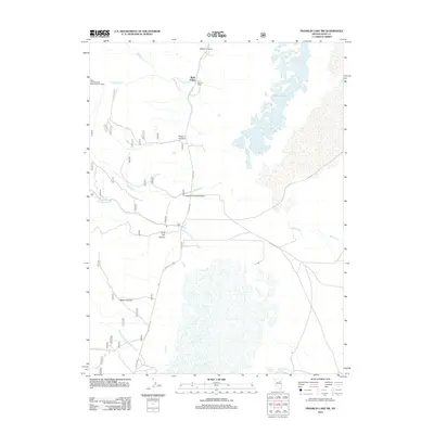
2012 Map of Franklin Lake SW
USGS Topo · Published 2012About this map
Ruby Valley serves as the focal point for this high-desert landscape in eastern Nevada, where agricultural life and recreational access meet along the western shore of Franklin Lake. The map details a network of canyons and creeks descending from the surrounding heights, including Wilson Canyon, Longhair Smith Canyon, and Lime Kiln Canyon. Local ranching history is evidenced by the Gardner Ranch and established water sources such as Gardner Spring and Smith Ranch Spring. This area is also a gateway for outdoor exploration, marked by the Ruby Crest National Recreation Trail Head. Surface drainage is defined by seasonal features like Ruby Wash and several creeks, including Harrison Pass Cr and Smiths Cr, which trace the drainage patterns typical of the Great Basin's interior basins.
Find a feature on this map
21 named features on this map. Tap any name to fly to it.
Don’t see what you’re looking for? This feature index may not catch every label — zoom into the map to look around manually.
Map Details
Editions of this 2012 Franklin Lake SW Map
This is the sole edition of this map. No revisions or reprints were ever made.
Other maps of this area

1934 · Jiggs
USGS Topo · 1:125,000

1937 · Jiggs
USGS Topo · 1:125,000

1955 · Elko
USGS Topo · 1:250,000

1958 · Elko
USGS Topo · 1:250,000

1959 · Jiggs
USGS Topo · 1:62,500

1959 · Sherman Mtn
USGS Topo · 1:62,500

1962 · Elko
USGS Topo · 1:250,000

1965 · Elko
USGS Topo · 1:250,000

1968 · Franklin Lake SE
USGS Topo · 1:24,000

1968 · Franklin Lake SW
USGS Topo · 1:24,000