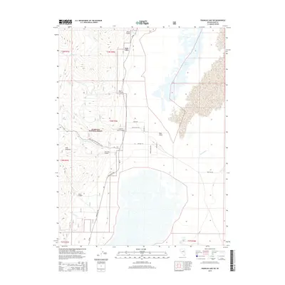
2015 Map of Franklin Lake SW
USGS Topo · Published 2015About this map
Ruby Valley and the eastern slopes of the Ruby Mountains dominate this landscape, where the high desert floor meets the rugged western terrain of the Humboldt National Forest. The map documents a complex drainage system flowing from the heights into the seasonal waters of Franklin Lake, including Harrison Pass Cr, Smiths Cr, and Gardner Cr. The human geography of the valley is defined by long, straight north-south roads like Ruby Valley Rd and CR-788, alongside family-named sites such as Smith Ranch Spring and Gardner Spring. Numerous canyons, including Wilson Canyon, Longhair Smith Canyon, and Lime Kiln Canyon, provide geographic context for the varied topography that transitions from the forested peaks down to the expansive basin of Ruby Wash.
Find a feature on this map
35 named features on this map. Tap any name to fly to it.
Don’t see what you’re looking for? This feature index may not catch every label — zoom into the map to look around manually.
Map Details
Editions of this 2015 Franklin Lake SW Map
This is the sole edition of this map. No revisions or reprints were ever made.
Other maps of this area

1934 · Jiggs
USGS Topo · 1:125,000

1937 · Jiggs
USGS Topo · 1:125,000

1955 · Elko
USGS Topo · 1:250,000

1958 · Elko
USGS Topo · 1:250,000

1959 · Jiggs
USGS Topo · 1:62,500

1959 · Sherman Mtn
USGS Topo · 1:62,500

1962 · Elko
USGS Topo · 1:250,000

1965 · Elko
USGS Topo · 1:250,000

1968 · Franklin Lake SE
USGS Topo · 1:24,000

1968 · Franklin Lake SW
USGS Topo · 1:24,000