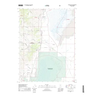
2018 Map of Franklin Lake SW
USGS Topo · Published 2018About this map
Ruby Lake National Wildlife Refuge dominates the southern landscape of this 2018 survey, where the Ruby Lake North Marsh transitions into the high desert valley. This region of Ruby Valley serves as a critical hydrologic interface, receiving drainage from the steep Ruby Mountains to the west through numerous drainages such as Wilson Canyon and Lime Kiln Canyon. The map details a network of specialized access roads like Harrison Pass Rd and Ruby Wash Rd, which historically supported local industry and ranching.
Find a feature on this map
65 named features on this map. Tap any name to fly to it.
Don’t see what you’re looking for? This feature index may not catch every label — zoom into the map to look around manually.
Map Details
Editions of this 2018 Franklin Lake SW Map
This is the sole edition of this map. No revisions or reprints were ever made.
Other maps of this area

1934 · Jiggs
USGS Topo · 1:125,000

1937 · Jiggs
USGS Topo · 1:125,000

1955 · Elko
USGS Topo · 1:250,000

1958 · Elko
USGS Topo · 1:250,000

1959 · Jiggs
USGS Topo · 1:62,500

1959 · Sherman Mtn
USGS Topo · 1:62,500

1962 · Elko
USGS Topo · 1:250,000

1965 · Elko
USGS Topo · 1:250,000

1968 · Franklin Lake SE
USGS Topo · 1:24,000

1968 · Franklin Lake SW
USGS Topo · 1:24,000