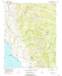
1955 Map of Franklin Point
USGS Topo · Published 1973About this map
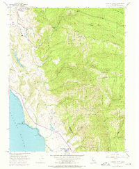
Punta Del Ano Nuevo defines the rugged coastline of southern San Mateo County in the mid-1950s, where the Santa Cruz Mountains meet the Pacific Ocean. This survey captures a transitional coastal landscape of Sand Dunes and established timberlands, notably within Butano State Park and Big Basin Redwoods State Park. Early industrial and educational markers are visible, including a Quarry near Whitehouse Creek, a coastal Oil Well, and the Pescadero High Sch in the northern portion of the sheet. Inland, the terrain rises sharply toward Chalk Mtn and Butano Ridge, drained by a network of steep canyons including Gazos Creek and Ano Nuevo Creek. The mapping also identifies remote outposts like the Sandy Point Guard Station and established recreation sites at Butano Park, reflecting the era's balance of resource extraction and early conservation efforts.
Find a feature on this map
48 named features on this map. Tap any name to fly to it.
Don’t see what you’re looking for? This feature index may not catch every label — zoom into the map to look around manually.
Map Details
Editions of this 1955 Franklin Point Map
5 editions found
Other maps of this area

1897 · Palo Alto
USGS Topo · 1:62,500

1899 · Palo Alto
USGS Topo · 1:62,500

1902 · Santa Cruz
USGS Topo · 1:125,000

1940 · Halfmoon Bay
USGS Topo · 1:62,500

1940 · Ano Nuevo
USGS Topo · 1:62,500

1941 · Ano Nuevo Pt.
USGS Topo · 1:62,500

1941 · Palo Alto
USGS Topo · 1:62,500

1942 · Ano Nuevo
USGS Topo · 1:62,500

1943 · Palo Alto
USGS Topo · 1:62,500

1943 · Halfmoon Bay
USGS Topo · 1:62,500