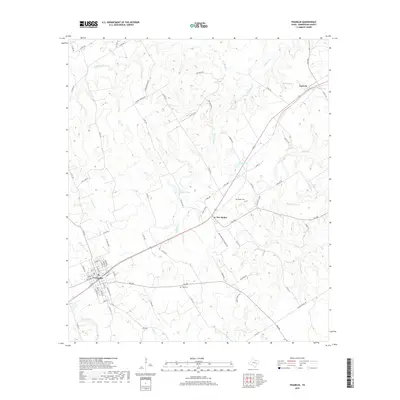
2019 Map of Franklin
USGS Topo · Published 2019About this map
Franklin serves as a primary hub on this Robertson County landscape, where a dense network of local streets like Main St, S Owensville St, and Center St converge. Moving northeast, the terrain is defined by the drainage basins of N Mineral Cr and S Mineral Cr, which feed into various small reservoirs including Schultz Lake and Casey Lake. The rural character of the area is punctuated by smaller settlements such as New Baden and Easterly, the latter positioned along a prominent rail corridor. Genealogists and local historians will find the locations of the New Baden Cem and Hale Cem particularly useful for grounding family records. The map also reveals the intricate creek systems that carve through the countryside, from Reiss Cr to the creatively named Wolf Den Br.
Find a feature on this map
83 named features on this map. Tap any name to fly to it.
Don’t see what you’re looking for? This feature index may not catch every label — zoom into the map to look around manually.
Map Details
Editions of this 2019 Franklin Map
This is the sole edition of this map. No revisions or reprints were ever made.
Other maps of this area

1925 · Marquez No. 1
USGS Topo · 1:48,000

1925 · Marquez No. 4
USGS Topo · 1:48,000

1927 · Marquez
USGS Topo · 1:62,500

1930 · Marquez
USGS Topo · 1:62,500

1954 · Waco
USGS Topo · 1:250,000

1954 · Austin
USGS Topo · 1:250,000

1955 · Waco
USGS Topo · 1:250,000

1961 · Hearne North
USGS Topo · 1:24,000

1962 · Edge
USGS Topo · 1:24,000

1962 · Wheelock
USGS Topo · 1:24,000