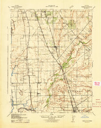
1941 Map of Franklin
USGS Topo · Published 1942About this map
Bradford Winery and the agricultural lands south of Sacramento define this 1941 landscape, which captures a critical moment in the development of Central Valley transit and irrigation. The map reveals an intricate network of competing rail lines, including the Southern Pacific (Niles Line) and the Central California Traction Railway, as they converge near Elk Grove and Galt. The transition from rural homesteads to more formalized settlements is evident in the density of local schoolhouses like Carroll Sch and Reese School, which served the farming families of Bruceville and Hicksville.
Find a feature on this map
44 named features on this map. Tap any name to fly to it.
Don’t see what you’re looking for? This feature index may not catch every label — zoom into the map to look around manually.
Map Details
Editions of this 1941 Franklin Map
This is the sole edition of this map. No revisions or reprints were ever made.
Other maps of this area

1891 · Sacramento
USGS Topo · 1:125,000

1892 · Sacramento
USGS Topo · 1:125,000

1893 · Sacramento
USGS Topo · 1:125,000

1894 · Lodi
USGS Topo · 1:125,000

1902 · Fairoaks
USGS Topo · 1:62,500

1907 · Davisville
USGS Topo · 1:62,500

1908 · Courtland
USGS Topo · 1:62,500

1908 · Buffalo Creek
USGS Topo · 1:31,680

1908 · Lockeford
USGS Topo · 1:31,680

1909 · Elk Grove
USGS Topo · 1:31,680