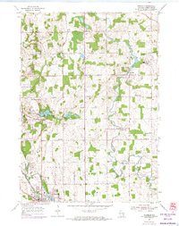
1954 Map of Franklin
USGS Topo · Published 1974About this map
The Sheboygan River winds through the rolling farm country of western Sheboygan County, anchoring a landscape defined by 19th-century township boundaries and tight-knit dairy communities. This mid-century view captures the cultural transition of the era, where the traditional campus of Mission House College and the Rocky Knoll Sanatorium stand alongside the emerging modern recreation of Road America.
Find a feature on this map
37 named features on this map. Tap any name to fly to it.
Don’t see what you’re looking for? This feature index may not catch every label — zoom into the map to look around manually.
Map Details
Editions of this 1954 Franklin Map
3 editions found
Other maps of this area

1954 · Sheboygan Falls
USGS Topo · 1:62,500

1954 · School Hill
USGS Topo · 1:24,000

1954 · Sheboygan Falls
USGS Topo · 1:24,000

1954 · St. Wendel
USGS Topo · 1:24,000

1954 · Howards Grove
USGS Topo · 1:62,500

1954 · Howards Grove
USGS Topo · 1:24,000

1954 · Franklin
USGS Topo · 1:24,000

1954 · Kiel
USGS Topo · 1:62,500

1954 · Milwaukee
USGS Topo · 1:250,000

1955 · Kewaskum
USGS Topo · 1:62,500