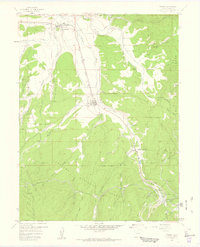
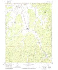
1957 Map of Fraser
USGS Topo · Published 1959About this map
The Fraser River valley dominates this mid-century landscape, serving as a critical corridor for both hydraulic engineering and mountain transportation. The presence of the Moffat Tunnel and its sequence of numbered portals, including Tunnel No 1, Tunnel No 2, and Tunnel No 3, highlights the massive infrastructure required to traverse the Continental Divide. Along the Denver and Rio Grande Western railroad, small mountain communities like Fraser and Tabernash anchor the region's development.
Find a feature on this map
50 named features on this map. Tap any name to fly to it.
Don’t see what you’re looking for? This feature index may not catch every label — zoom into the map to look around manually.
Map Details
Editions of this 1957 Fraser Map
5 editions found
Other maps of this area

1905 · Central City
USGS Topo · 1:62,500

1910 · Central City
USGS Topo · 1:62,500

1912 · Central City
USGS Topo · 1:62,500

1915 · Longs Peak
USGS Topo · 1:125,000

1919 · Rocky Mountain National Park
USGS Topo · 1:125,000

1924 · Fraser
USGS Topo · 1:62,500

1926 · Fraser
USGS Topo · 1:62,500

1953 · Denver
USGS Topo · 1:250,000

1954 · Greeley
USGS Topo · 1:250,000

1957 · Denver
USGS Topo · 1:250,000